

C-MAP Electronic Charts Insight Planner Navigational Planning Software DVD
Original price was: $29.99.$19.79Current price is: $19.79.
- 100% environmentally friendly material
- 100% High Quality Guarantee
- Online assistance, always at your service.
- 7 days return and exchange

Insight Planner is the ultimate PC software for marine navigation planning with Lowrance chartplotters. Create waypoints, routes, and points of interest (POIs), on a wide variety of supported cartography platforms such as Insight, Navionics, and raster charts using the BSB format.
Key Features:
Seamlessly plan and transfer routes, waypoints and POIs:
- Splitscreen options allow you to view multiple charts from different supported formats at different zoom levels.
- Plan routes using multiple charts for verification and safety purposes.
- Transfer waypoints directly to Google Earth or GPX file.
- Plan and transfer using Lowrance waypoint and POI icons.
Use multiple vector and raster charts including:
- Insight charts including Lake, Nautic, Topo and Genesis
- C-MAP by Jeppeson
- Navionics Platinum+, Platinum, Gold+, HotMaps Premium, and HotMaps Platinum charts
- S-57 nautical charts (e.g. NOAA ENC, Army Corps iENC)
- S-63 Encrypted ENC charts (requires user permit)
- BSB Version 1 through 5 raster nautical charts (NOAA RNC, MAPTECH, CHS, NDI DigitalOcean, Fugawi, GPS GmbH)
- NV.Digital (BSB/EAP from Nautische Veröffentlichung Verlagsgesell)
- TRAK Maps
| Compatibility | PC's, Lowrance, Chartplotters |
|---|---|
| Type | Software |
Be the first to review “C-MAP Electronic Charts Insight Planner Navigational Planning Software DVD”
Related products
Electronics & navigation
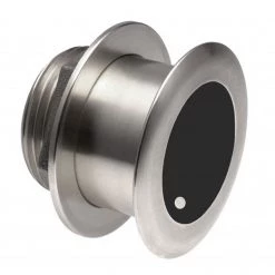
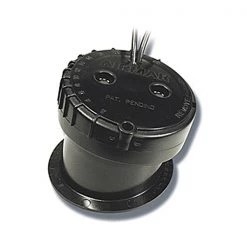
SIMRAD Transducers XSonic SS175L 20° Tilt Thru-Hull Low CHIRP Transducer
Electronics & navigation
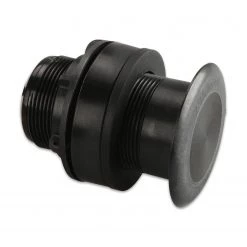
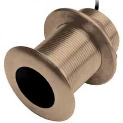
GARMIN Transducers Airmar P319 Thru-Hull Dual Frequency Transducer
Electronics & navigation
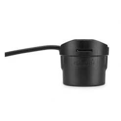
GARMIN Transducers GT8HW-IH In-Hull High/Wide CHIRP Transducer
Electronics & navigation
Electronics & navigation
GARMIN Transducers B619 12° Tilt Thru-Hull Dual Frequency Transducer
Electronics & navigation
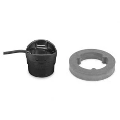
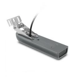
GARMIN Transducers GT51M-TM Transom Mount Traditional And CHIRP ClearVu/SideVu Transducer
Electronics & navigation
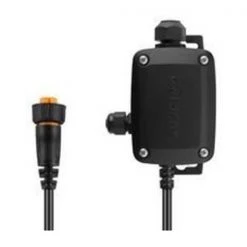
GARMIN Transducers Bare Wire Transducer To 12-pin Sounder Wire Block Adapter
Electronics & navigation
Reviews
There are no reviews yet.